
This month we will visit picturesque Dunbar, Penn., an old coal and iron town nestled in the foothills of Chestnut Ridge, between Connellsville and Uniontown in Fayette County, a subdivision located south of Pittsburgh in the southwestern corner of the state. I recently acquired a nice note from this town and had the opportunity to visit it and find its bank. We will also have the chance to visit an old Turnpike Gate in Western Maryland.
Dunbar is located roughly halfway between Connellsville and Uniontown and can be found just a few miles off U.S. Route 119 to the southeast via State Route 1053. This local road meanders and winds before reaching Dunbar, which sits rather forlornly along the Dunbar Run. Although once a rather prosperous coal town, the population boomed in 1910 at 2,000 and has shrunk to half that today. It is typical of the many now shattered coal towns in this part of Pennsylvania.
The area that became Dunbar, Penn., was originally settled in the 1790s but was not incorporated as a town until 1883. Originally called Frogtown, the name was changed to Dunbar City and finally Dunbar in honor of Col. Thomas Dunbar, who was in charge of the (British) 48th Regiment of Foot, who, along with Gen. Edward Braddock, came to America in 1755 to attack and regain control of Fort Duquesne during the yet to be declared French and Indian War. Dunbar’s Camp was located in the vicinity of the town.
The establishment of the Union Furnace #1 by Isaac Meason was the start of what would become Dunbar’s lifeblood. The community evolved because of the furnace’s need for workers and community services needed by the new residents. For well over 100 years, “Dunbar Iron” was known far and wide for its quality, and the area along Dunbar Run Creek was rich in mineral resources. This resulted in many other industries springing up as the Industrial Revolution dictated changes in the needs of the time. The coal and coke era contributed to Dunbar’s growth during the latter half of the 19th century and into the early years of the 20th century.
Dunbar’s heyday peaked around 1915 when the town boasted the Semet-Solvay By-products ovens, the Pennsylvania Wire Glass Company, a huge sand plant with sand that was well known for its quality, bluestone quarries, coal and coke ovens, an ice plant, brickworks and a myriad of smaller businesses that operated in town.
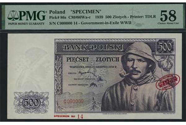
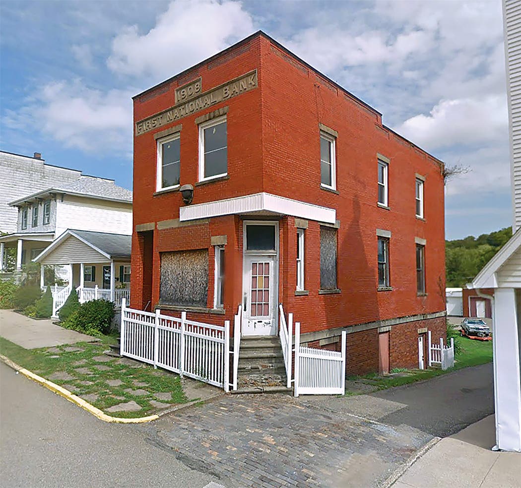
This growth resulted in the creation of the First National Bank of Dunbar, which received charter #7576 at the beginning of 1905. It was a “large-only” issuer, circulating roughly $750,000 in notes prior to being closed by the receiver in 1927, a direct result of the collapse of the coal and coke industry in the 1920s. It issued all three types of Series of 1902 notes that were in circulation during its lifetime. Currently, eight notes are reported in the census. I had one years ago but sold it, and having visited the town and seen the bank, I came to regret it. A few notes have appeared on the market since, but I held out until the unique Red Seal note came up for auction, so I bought it. I have included a photo with this article. It is a nice example, and these small coal-town Red Seals are quite hard to find and give depth to one’s collection. Note the lovely pen signatures of C.D. Kimball, cashier, and S.H. Patterson, vice president.
Through the years, Dunbar suffered from several floods that inundated the community and fires that almost destroyed the small town. After each, the people of the town pulled themselves up and rebuilt. Nonetheless, the town has simply never recovered from the economic downturns of the 1920s and 1930s. The plethora of substantial brick buildings in the town, many abandoned or underutilized, is clear evidence of the prosperity that once reigned in the area when coal, coke, and iron were kings.
Many impressive buildings remain. The old First National Bank was part of a sizeable brick block at the head of Main Street. This eerily abandoned edifice was once one of the main business blocks in town. The bank was located on the right-hand side of the building, and the ground floor entrances were all boarded up with bright red planking. Railroad tracks bisect the town near the creek, and remnants of the once bustling town are all around. Not far away, I spied the old George H. Swearingen General Merchandise building. This proud structure once housed one of the largest general store suppliers in the region. Today, its once-busy ground level has been closed off, though the upper floors still support some apartments. I have included a vintage photo of this block and adjacent buildings circa 1910, as well as the same view as it appears today.
I also found an interesting little narrow corner edifice, which today holds a dental office but once was an important commercial structure. This style of narrow architecture, designed to accommodate narrow plots resulting from street layout, is very reminiscent of the turn of the 20th Century, and buildings of this type are hard to find still standing. I did not really have enough time to thoroughly explore the town, but I would certainly hope to revisit it someday. In addition to exploring its fascinating history and period architecture, visitors can access the Youghiogheny River Trail. This 71-mile trail is a portion of the Great Allegheny Passage that stretches from Pittsburgh to Washington, D.C. Visitors also have access to the Sheepskin Trail, which is part of the rail-to-trail project and will eventually connect the Great Allegheny Passage to the Potomac Heritage National Scenic Trail and the West Virginia rail-to-trail system. I would recommend a stop at Dunbar to anyone traveling in this part of southwestern Pennsylvania.
I headed southwest back into Maryland via U.S. 119 and U.S. Route 40, and I stopped for a bite to eat at LaVale, just north of Cumberland. Almost by chance, I stumbled across the very well-preserved National Road turnpike gate and tollhouse that sits alongside U.S. 40. This highway, once known as the National Road, was the first administratively planned and nationally financed highway. It stretched west from Baltimore across the Alleghenies into Ohio. It was constructed in stages, with each section being administered as a separate facility. This gate, one of the few well-preserved tollhouse gates in the nation, was part of the Cumberland and Oakland Turnpike Road.
I have included a photo of the tollhouse and a photo of the Rates of Toll price sheet that still remains on the structure. After visiting the LaVale gate, I became intrigued with the idea of turnpike roads, as I knew that many of these issued their own obsolete currency and scrip. When I got home, I did some research into this. I was unable to locate any issue of currency from the particular gate that I visited in LaVale, but I did find that many Turnpike Road companies along the East Coast did issue currency, as well as scrip that was accepted at turnpike gates.
In general, the obsolete currency notes issued by the turnpike companies themselves are generally available to collectors. I have included a photo of a $1 note issued by the Pittsburgh & Butler Turnpike Road Company in 1822. This type of currency was an obligation of the corporation and issued to fund the construction and maintenance of the turnpike road itself. The small change scrip notes, redeemable for bank notes or accepted for tolls at the gates, are generally considerably scarcer. A wonderful and very rare piece of scrip of 1816 “will pass at any of the Reister’s-Town Turnpike Gates for Twelve and a Half Cents.” This one is of particular interest to me, as Reisterstown (as it is known today) is only 6 miles north of my house, along a very busy suburban thoroughfare known as Reisterstown Road (Md Route 140). This busy four-lane road, which I use regularly, runs along the original path of the Reister’s Town Turnpike. Unfortunately, none of the turnpike gatehouses still stand. This note is from my collection.
Readers may address questions or comments about this article or national bank notes in general to Mark Hotz directly by email at markbhotz@gmail.com.